Coastal Storms Fellow creates tool to predict flooding that can block evacuation
More than two hours before Hurricane Ike hit Galveston, Texas, in 2008, water levels swelled to almost two meters above average. It wasn’t predicted and caught emergency managers and residents off guard. Researchers call this water level increase ahead of a hurricane a forerunner surge.
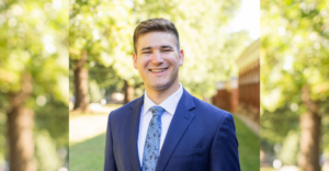
“The danger of a forerunner surge is that it can really affect when you evacuate people,” says Yi Liu. “If you miss that chance, many people can get stranded like what happened with Hurricane Ike.”
Storm surges can be difficult to predict because forecasts favor either accuracy or speed. Models that provide timely projections can’t provide the same level of detail as slower models, which are more precise but take longer for computers to process. As a part of her doctoral work in civil engineering at Virginia Tech and her role as a NOAA/Virginia Sea Grant Coastal Storms Fellow, Liu tried to achieve the best of both worlds—a forecast for storm surges that was fast and reliable. The equations predict both the height and timing of forerunner surges.
“The timing of storm surge is critical for key decision makers,” says Jeff Orrock, meteorologist in charge at the National Weather Service office in Wakefield, Virginia. “Knowing when the water will rise and how long flooding will persist are vital pieces of information.”
The effects of storm surge depend on the coastal features specific to a region, so Liu used data from simulated storms specific to the coasts of Texas, New York, and Virginia to develop her equations. Two models provided her with detailed meteorological and water level information about each storm. The storms she studied—more than 100—spanned the range of possible storms that might affect each area.
“They’re not real hurricanes, but they represent the real statistics of the storm climatology in that area,” Liu says.
“The danger of a forerunner surge is that it can really affect when you evacuate people,” says Yi Liu. “If you miss that chance, many people can get stranded.”
Liu developed a set of equations that predict the timing and heights of forerunner surges. These equations are designed so that forecasters can incorporate readily available storm information to make timely decisions. The equations show the mathematical relationship between forerunner surges and a storm’s size, intensity, and moving speed—the three characteristics Liu proved to have the strongest influence on forerunner surges.
“The idea is to look at the possible range of the storm parameters in that space and draw out an equation or a curve that any storm can fall on,” Liu explains. “If a storm comes in and the parameters are within my simulation range, I can put that storm on my curve and interpolate the timing and height of the forerunner surge.”
Even though Virginia is a long way from the Texas hurricane that first inspired Liu’s research, Hampton Roads and Galveston have a lot in common: They are flat, populated areas that rely on bridges for evacuation. Knowing when forerunner surges might affect communities will allow emergency managers to make evacuation decisions with confidence.
“The timing of storm surge is critical,” Orrock says. “Tools developed to help decisionmakers visualize surge go a long way in painting the picture of hurricane impacts.”
Takeaways:
Forerunner surges, the water level rises before hurricane landfall, can cause flooding and prevent communities from evacuating.
Storm surge models with the highest accuracy can often take a long time to process all the information, whereas other models sacrifice accuracy for speed.
Yi Liu, a coastal storms fellow, developed equations that forecast the timing and height of forerunner surges.
The equations provide decisionmakers with fast and reliable information
Photos and video by Aileen Devlin | Virginia Sea Grant Contributed photo from Yi Liu Story by Madeleine Jepsen | Virginia Sea Grant Published Oct. 12, 2018.
The effects of storm surge depend on the coastal features specific to a region, so Liu used data from simulated storms specific to the coasts of Texas, New York, and Virginia to develop her equations.
Even though Virginia is a long way from the Texas hurricane that first inspired Liu’s research, Hampton Roads and Galveston have a lot in common: They are flat, populated areas that rely on bridges for evacuation.