Digital Coast fellow shows how coastal planning and prep pays off for Gulf Coast
Coastal localities know firsthand the cost of flooding and natural disasters, but planning for these disasters—and knowing what kinds of projects are most effective at the local level—can be especially challenging in rural areas.
To shed light on effective local strategies, Digital Coast Fellow Shanna Williamson is conducting a survey of 20 coastal counties and parishes along the Gulf Coast. Williamson has analyzed their comprehensive and hazard mitigation plans, categorized completed projects, and will calculate the return on investment for the communities’ projects during her two-year National Oceanic and Atmospheric Administration fellowship at the National Association of Counties (NACo).
Already, Williamson has classified a wide range of mitigation strategies into five general categories. The most common approaches were infrastructure projects, followed by educational efforts and changes to local regulations.
“Structure and infrastructure projects would be your elevations, acquisitions, and retrofitting, as well as culvert expansions and levee modifications,” Williamson said.
The other two categories for action included protection of natural systems like dune or marsh rehabilitation, and participation in national preparedness programs offered through the Federal Emergency Management Agency (FEMA), including a response to previous hazards.
“There’s a lot of information from NOAA and FEMA about how much disasters cost, and there’s a lot of disaster spending around preparedness,” said Jenna Moran, former NACo associate program director for Resilience, Transportation, and infrastructure. “But we wanted to dig down deep into what counties have done around mitigation and how they’ve seen a return on that investment.”
Now, Williamson has reached out to each of the 20 counties and parishes to confirm which actions in their plans they have put in place, so she can calculate return on investment for the infrastructure projects.
“Sometimes, it may feel like they’re doing so much—and they have done so much, especially following significant hazardous events like Hurricane Katrina,” Williamson said. “Yet, it doesn’t necessarily feel like people recognize all that they have done and continue to do.”
As part of the fellowship project, Williamson will summarize her findings in fact sheets that break down regional and local trends so communities can communicate their local resilience efforts.
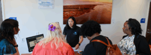
She also participated in a workshop for Gulf Coast county planners, coastal managers, and elected officials that connected regional leaders and provided them updated technical information on topics like flood economics and watershed planning. While there, she was able to meet some of the local planners from the counties she was collaborating with.
“Sometimes, it may feel like they’re doing so much—and they have done so much, especially following significant hazardous events like Hurricane Katrina,” Williamson said.
As part of the fellowship project, Williamson will summarize her findings in fact sheets that break down regional and local trends so communities can communicate their local resilience efforts.
“I’ve had opportunities to reach out to the counties to explain to them what the results of the first part of my project have been, and they have expressed that it was great to hear everything they’ve done summarized in comparison to other counties and parishes in the region,” Williamson said.
After studying how climate and land use affected waterways as a master’s student at the Virginia Institute of Marine Science, Williamson said the fellowship showed her how decision-makers interact with science—and how to communicate technical information in a meaningful way.
“I was just really interested in what my science means for the people who are affected by it,” Williamson said. “This fellowship gave me an opportunity to do that, while still keeping me plugged into climate science and coastal hazards and the intersection of science and people.”
Takeaways:
- NOAA Digital Coast Fellow Shanna Williamson is analyzing the flooding responses planned by 20 Gulf Coast Counties to determine common types of responses and their return on investment.
- Williamson, a VIMS alumna, said the fellowship has strengthened her ability to communicate technical information to different audiences.
- Williamson will also create fact sheets that convey each county’s actions and regional trends to give local planners a snapshot of local and regional resilience.
Photos and video by Aileen Devlin | Virginia Sea Grant
Story by Madeleine Jepsen | Virginia Sea Grant
Published April 10, 2020.
“This fellowship gave me an opportunity to do that, while still keeping me plugged into climate science and coastal hazards and the intersection of science and people,” Williamson said.


